


Advertisement.
Since the 1970s, water flowing through the La Martre River has increased more than anywhere else in the NWT. Scientists are trying to figure out why, and where all the water is coming from.
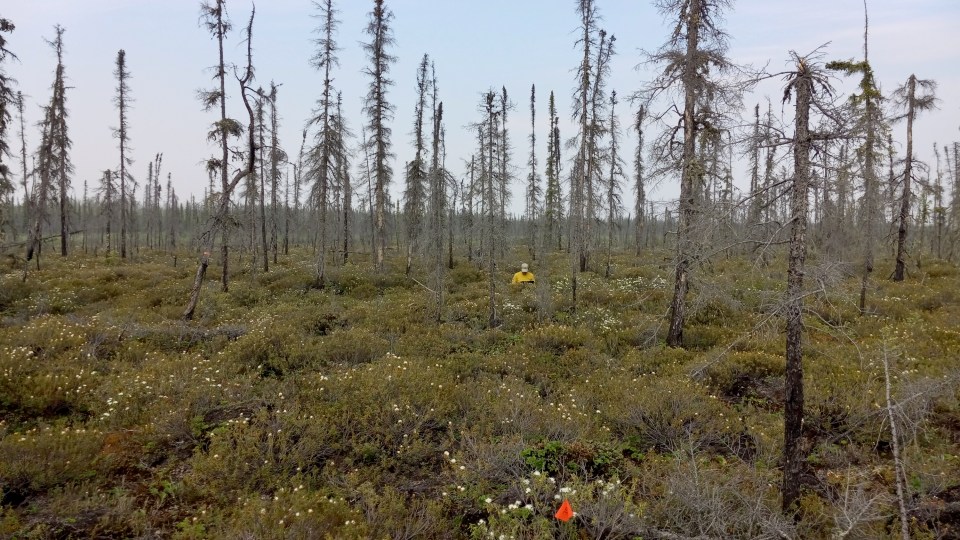
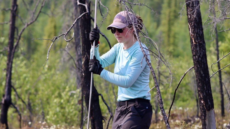
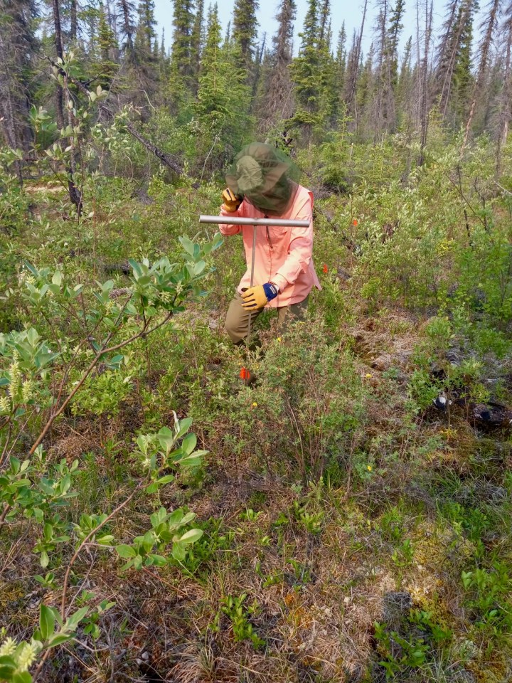
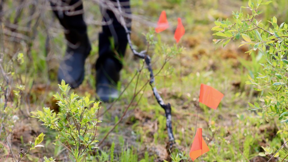
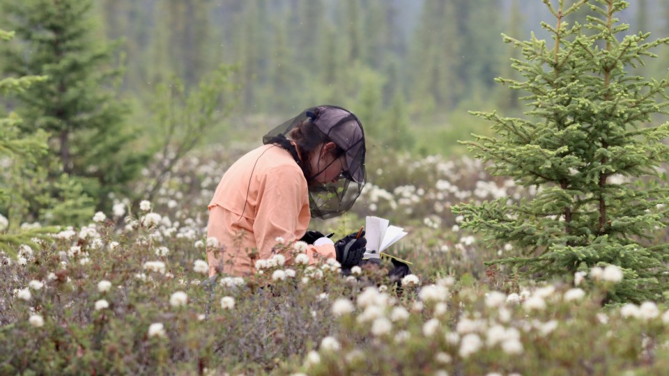
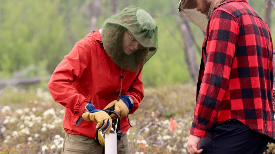
In a mossy expanse outside Whatì, graduate student Abbi Baran slammed a two-metre pole into the ground, wincing with effort through the June heat. She pounded the metal probe into the soil. Thunk. Thunk. Thunk.
Her nearby colleagues listened intently for a change.
Then, they heard it – a slightly higher-pitched sound hardly perceptible to my untrained ears. Everyone’s eyes went wide.
Advertisement.
Advertisement.
“That sounded like the high-pitched squeal of a talik,” Stephanie Wright, assistant professor in civil engineering at Queen’s University in Kingston and Baran’s supervisor, said jokingly.
The subtle change in sound, and a shift in the ground’s give, signified a change in the frozenness of the earth underfoot. Having already tunnelled the probe through a layer of seasonal frost, Baran had now pierced through the other side, finding unfrozen ground below and letting off what sounded to me like a faint hiss.
Taliks are layers of unfrozen ground in permafrost regions, typically found under rivers or lakes.
As the climate warms, they are forming above and within permafrost, too. There, they can act as underground conduits, allowing water to flow where it previously hadn’t.
Advertisement.
Advertisement.
Wright, Baran and Eric Leonard, a graduate student from Wilfrid Laurier University, had been looking for taliks in the bogs around Whatì all afternoon. Taliks are one of many clues that might help explain why so much water is flowing through the La Martre River, just a few hundred metres away.
The La Martre River starts at the outlet of Lac La Martre, near Whatì, and eventually flows east into the Marian River, north of Behchokǫ̀.
Of the territory’s many river systems, the La Martre has seen one of the biggest increases in flow rates over the past few decades.
Average annual streamflow roughly doubled between 1975 and 2020 according to Ryan Connon, a hydrologist at the NWT government. In the winter months, the change is even more pronounced – roughly quadrupling over the same period.
“It’s the most drastic change in the Northwest Territories,” said Connon, who is collaborating with Wright to investigate the increase in the river’s flow, along with Élise Devoie of Queen’s University and William Quinton of Wilfrid Laurier University.
While the team suspects the transformation has to do with permafrost thaw, it’s still not entirely clear why the La Martre is such an outlier.
To figure out what’s going on, Connon, Wright and their colleagues have embarked on a research project to uncover why so much water is moving through the river and where it’s coming from.
Solving the mystery could shed light on what the change might mean for fish, wildlife, local flood risks and drinking water, the researchers say.
Advertisement.
Advertisement.
Uncovering the processes at play in the La Martre could also provide a stepping stone to answering bigger-picture questions about how warming stands to change some of the territory’s largest river systems.
Process of elimination
Throughout the North, climate change is affecting water above and below ground in sometimes surprising ways.
Arctic lakes have been known to shrink or disappear, sometimes within a matter of months or even days. The process, known as catastrophic lake drainage, is thought to occur when thawing permafrost opens drainage channels, like pulling the plug out of a bathtub.
In the Yukon, large stretches of the Fishing Branch River have been drying out in recent years for reasons that aren’t entirely understood, killing thousands of salmon fry and eggs.
Although scientists still know relatively little about how surface water, groundwater and permafrost interact, it’s apparent that some climate-induced changes are abrupt but others, like the increase in La Martre River streamflow, build slowly over time.
Connon first noticed the La Martre River change when he started working as an NWT government hydrologist in the late 2010s.
Looking to better understand changes in water throughout the territory, he combed through data collected by the Water Survey of Canada, which has roughly 90 gauging stations in the territory.
The data for the La Martre River stood out.
Advertisement.
Advertisement.
Comparing average annual flows in 1975 to 2020, Connon said the difference in water flowing through the La Martre River equates to about 1.8 million additional cubic metres per day – roughly 700 Olympic-sized swimming pools.
Keep in mind, Connon noted, the river already carries a substantial amount of water and drains an area almost three times the size of Prince Edward Island.
On top of a steady rise in streamflow over the past 40-odd years, data from the Water Survey of Canada also shows increasing year-to-year fluctuations in the amount of water moving through the river, Wright said.
This past summer, for instance, streamflow dipped into the lower end of its historical range. But unlike most rivers in the southern NWT, even during this year’s extreme drought, the La Martre did not reach a record low, Connon said, suggesting the mechanisms that bring water into the river have changed.
Scientists have previously noted increased streamflow in the La Martre river. Until now, no one had examined the reasons behind it.

To narrow the list of possible explanations, Connon and his colleagues used a process of elimination.
First, they looked at precipitation. Although records are limited, some data suggests basin has been getting more precipitation, Connon said. Still, the amount is not nearly enough to account for the change in streamflow. The river’s flows are also highest in winter, he said, when precipitation doesn’t add to water levels.
“That signature tells us it’s likely a groundwater question,” Connon said.
Advertisement.
Advertisement.
Hydrologists have long thought of winter as a dormant phase, when everything down to the permafrost freezes. But that’s no longer the case, Connon said. Sometimes, a layer of soil that thaws in the summer doesn’t freeze all the way down, allowing water to move through the subsurface in winter – a phenomenon he said the field wouldn’t have expected to see 20 years ago.
Adding to the evidence that groundwater is involved, Connon said other areas of the watershed appear to be drying out. At a water stewardship meeting a few years ago, he said, Tłı̨chǫ residents had spoken of not being able to paddle to areas they previously reached by boat, because of low water levels.
Based on these clues, the research team developed a hypothesis. As permafrost thaws, they suspect the frozen barrier separating surface water from deep aquifers is deteriorating. More rain and surface water can therefore drain into underground aquifers. That water flows into Lac La Martre and subsequently into the river.
“Essentially, what we’re thinking is that the water is moving through the landscape more easily. It’s not just falling and sitting in these areas on top of permafrost,” Connon said.
But there are still a lot of details to uncover about exactly how the process plays out.
“We know that there’s more water moving through the system, but where is it coming from?” Connon said. “Which areas are drying out? Which areas are becoming wetter? And how is that impacting cycling and storage of water across the entire basin?”
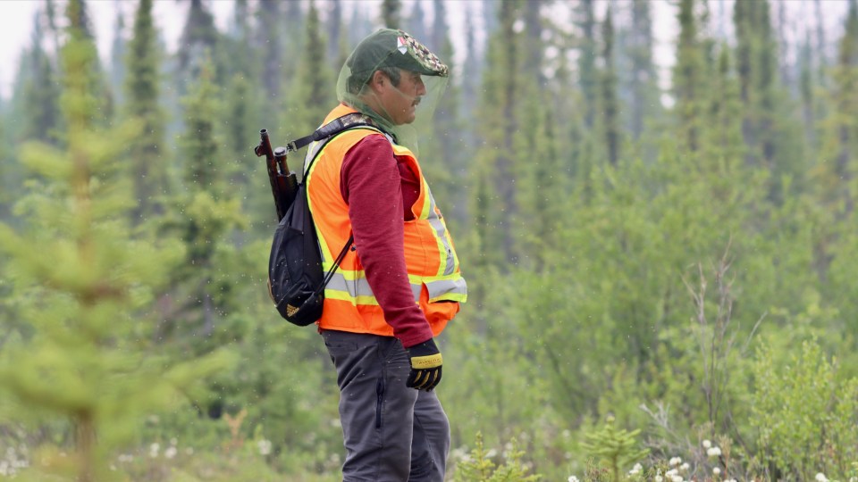
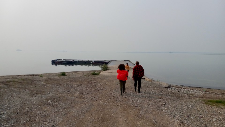
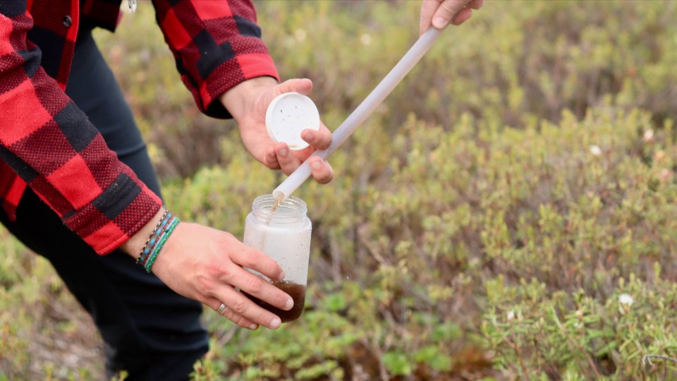
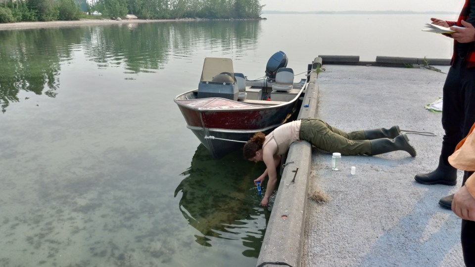
To answer those questions, the research team has been collecting data on the La Martre catchment since the summer of 2022. This past June, Wright, Baran and Leonard spent a week measuring water levels, temperatures, and the depth of permafrost and taliks. Along with Connon, the crew also set up a meteorological station on the north end of Lac La Martre, where information on conditions had been lacking.
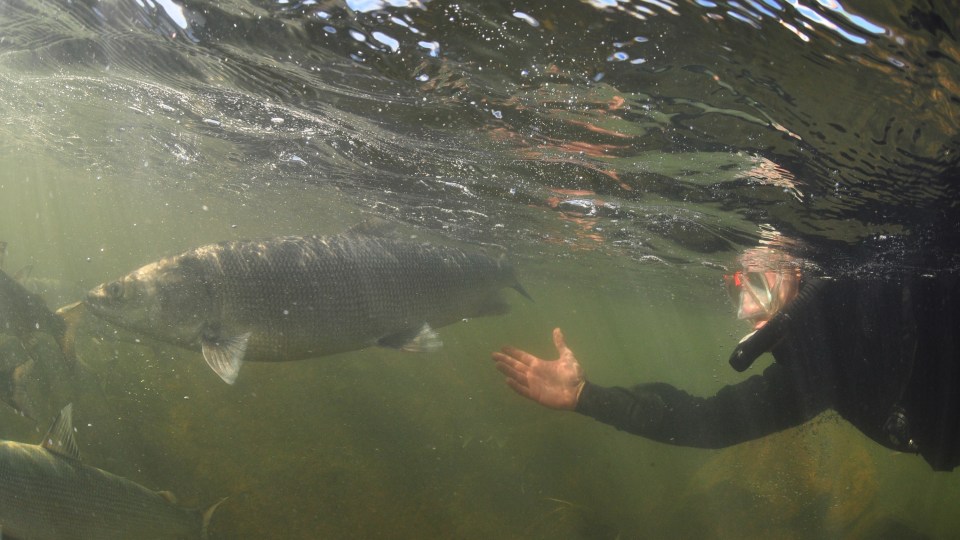
The researchers collected water samples from various locations in the watershed, too, which will be used to help gauge how water is moving – a process that Wright likens to detective work. After lab testing, she and her colleagues will be able to examine the samples’ chemical features, which she said differ between water sources such as snow, rain, groundwater, and surface water. If two water samples share similarities, Wright explained, their sources are likely connected.
Advertisement.
Advertisement.
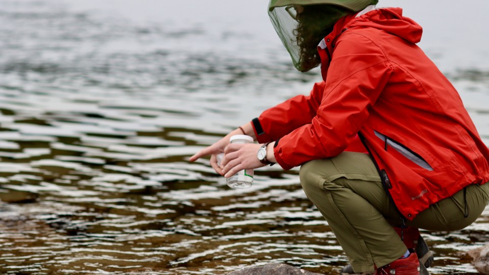
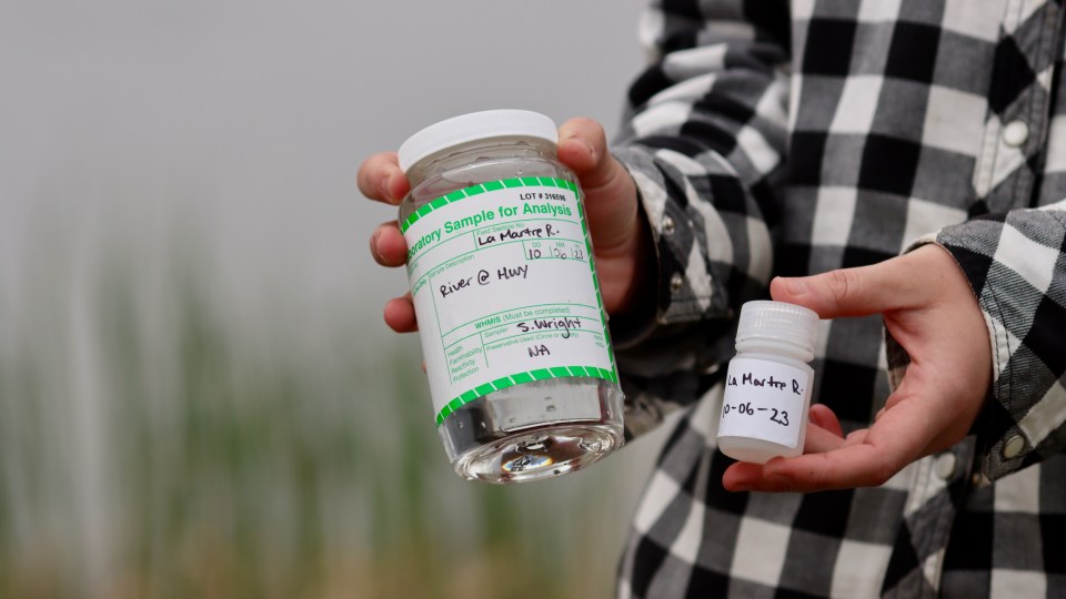
When I joined the researchers in the field in June, differences between samples were already apparent. Water samples ranged from crystal clear to coffee-coloured, and some packed a pungent rotten-egg odour.
“Can you smell that from over there?” Leonard asked me one day while standing several metres away, pumping water from a well. (I couldn’t.)
“It smells very sulphuric,” he added.
According to Wright, the data collected will be used to create a computer model that simulates what’s going on in the watershed.
“It’s very easy to just make a model of anything, but you need field data to be able to calibrate that model to the real world,” she said.
By playing with the model’s parameters until its output matches actual conditions in the river, Wright said the team can gain insight into how different processes are contributing to streamflow in the La Martre.
Once the model simulates the basin accurately, the researchers say, it could also be used to predict how the watershed may change in the future as more permafrost thaws – which could help answer questions about potential impacts on the region and its residents.
Unclear implications
Sonny Zoe, a councillor and member of the Tłı̨chǫ Government, has lived in Whatì for most of his life.
Advertisement.
Advertisement.
The community borders Lac La Martre, the territory’s third-largest lake. Zoe said the region’s water is more than just a source of drinking water to residents.
“Whatì survived by fishing,” Zoe said. “We didn’t have caribou come right up to us for many years, so people depended on fish.”
Earlier this year, Zoe said he noticed fish were sticking around in shallow parts of the lake longer than usual. Usually, he said, fish move into warmer, near-shore areas in the early spring and migrate back to deeper water around mid-June. But this year, he said, people were still catching fish close to the community in mid-July.
“I find that really strange,” he said, adding that if more water is coming into the lake, it might take longer for deeper areas to warm up in the spring.
But to Zoe, year-to-year fluctuations in water levels are much more noticeable than steady increases in streamflow.
When he went to his cabin on the shores of Lac La Martre earlier this spring, he said his dock was sitting on dry land.
Even in June, water levels in the La Martre River were particularly low, with rocks sticking out where they normally don’t, according to Richard Romi, a Whatì resident and bear monitor on the research project.
Zoe said changes in the region’s water are a concern for residents, adding there is a need to find out more about what may still lie ahead.
Advertisement.
Advertisement.
“If there is a problem with water, we have problems here,” he said.
According to Wright and Connon, alterations in the way water moves through the La Martre watershed could have a wide variety of repercussions for the community and the environment.
Whatì is one of only three communities in the territory that sources its drinking water from underground, Wright said. If thawing permafrost is allowing more water to reach the river, she said, the same processes might create new pathways for sources of contamination to reach drinking water supplies.
Increasing streamflow might also alter residents’ ability to travel, affect ice formation, or increase flood risk in the spring, when melting snow and ice add even more water to the system.
Changes in the river could affect wildlife, too. Zoe said drastic increases in the river’s flow have the potential to drown muskrat and beaver.
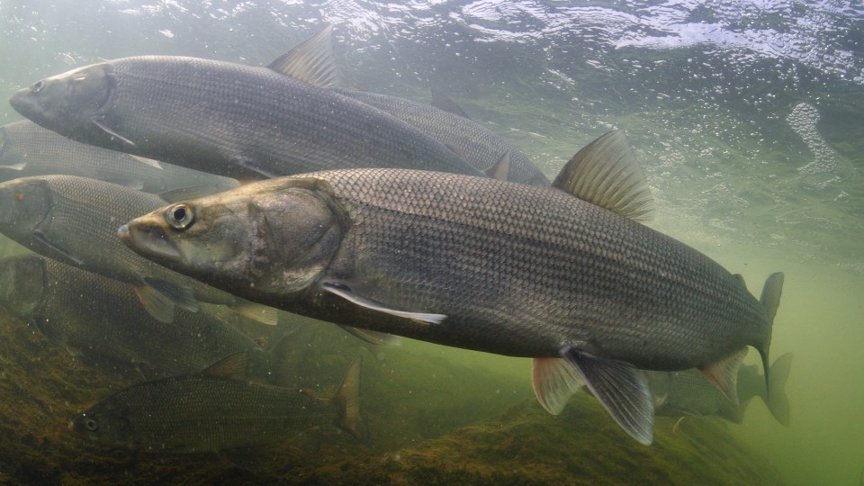
Then of course, there are the fish.
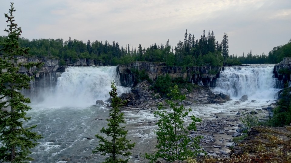
Roughly 20 kilometres east of Whatì, the La Martre River spills over a ledge of blocky cliffs at Whatì Falls. Below the falls is a stretch of shallow, fast-moving water that provides critical spawning habitat for coney, or inconnu, according to Paul Vecsei, a fisheries biologist for the Tłı̨chǫ Government.
For coney, increasing winter streamflow might actually be good news, Vecsei said.
Advertisement.
Advertisement.
The fish spawn in the fall and, when water levels naturally decline over winter, he said their eggs can dry out. Even in shallow water, Vecsei said, eggs aren’t entirely safe: Water in the La Martre can get so cold that ice forms on the river bottom, freezing eggs in place.
If streamflow is increasing, Vecsei said more eggs might survive the winter.
“Climate change is going to be a very, very good thing for some fish, or for some stages in the life history of some fish,” he said. “But it also will be very bad for other species.”
At this point, it’s clear the watershed is changing, according to Connon, but it’s still too soon to say what that might mean.
Questions remain about how the processes under way in the La Martre might affect bigger river systems, too. Connon said people often wonder how climate change is impacting the Mackenzie River, for instance.
That river basin is more than 100 times bigger than the La Martre River catchment. At 1.8 million square kilometres, it’s roughly the size of the NWT and Yukon combined.
“Answering questions about continental-scale basins is impossible until you can start small,” Connon said.
Previously, Connon has studied hydrological changes in the roughly 150-square-kilometre Scotty Creek basin in the Dehcho region. The La Martre River basin, at 14,000 square kilometres, represents a significant increase in size. If researchers can figure out what’s going on in the La Martre, Connon said, they can begin to understand how processes taking place in smaller basins scale up.
Advertisement.
Advertisement.
The investigation in the La Martre is far from over. After the June fieldwork, researchers went back to the area to collect more data in the fall. They have more fieldwork planned for 2024.
Wright said the research is currently funded until 2025. By then, she said, the team expects to have taken a first crack at modelling the basin, which she thinks will provide a rough idea of what’s going on.
But being able to confidently make predictions about how the La Martre catchment will change in the future, and what impacts those changes may have, will take a lot more work.
“We’re just scratching the surface,” Wright said.
Beyond 2025, the researchers plan to apply for more funding to continue collecting data and refining the model.
They intend to keep poking, prodding and gathering clues to gain a deeper understanding of what’s unfolding underfoot.