

Advertisement.
“We cannot plan right now to the specific details. We’re going to be faced with looking at options, seeing what’s available, and just doing what we can when the situation arises.”
John McKee, Fort Liard’s senior administrator, is tasked with working out what the hamlet’s 500 or so residents should do if a wildfire comes close enough to trigger an evacuation order.
The community has an airstrip at its disposal. Ordinarily, there’s a highway south to BC and a highway north to Fort Simpson, Hay River and beyond.
However, wildfires in northern BC have blocked Highway 7 south and large stretches of Highway 1 have been closed for long periods this week because of separate fires.
Advertisement.
Advertisement.
Meanwhile, a wildfire 19 km southwest of Fort Liard has the community on evacuation notice, meaning residents are told to prepare. An evacuation alert would be the next step.
McKee told Cabin Radio he met with NWT government officials on Tuesday morning to discuss evacuation options if Highway 1 is not available and residents need to leave.
He says the best evacuation option is by road if that’s possible, as it would disperse evacuees between multiple NWT communities such as Fort Simpson, Hay River and Yellowknife, easing the pressure on any one place.
McKee says the hamlet isn’t considering an evacuation to a nearby community like Nahanni Butte because it is too small and would strain resources.
Advertisement.
Advertisement.
An airlift to a centre like Yellowknife hasn’t been ruled out, but McKee said it’s impossible to make a call with any certainty yet because so many variables are shifting.
“You can’t be that exact,” he said, “because you don’t know the conditions.”
The NWT government’s territorial emergency management organization said “no formal request for assistance has been received” from the hamlet as yet.
“The hamlet has indicated that in the event of an evacuation they would require assistance with transportation. The GNWT is monitoring the situation closely and is examining transportation options as a contingency for the hamlet, if requested,” a GNWT spokesperson stated.
As of 1:45pm on Tuesday, Highway 1 was open, allowing supplies like fuel to enter the community. However, McKee warned there may be delays receiving essentials due to road conditions.
“Our only option now is north,” said McKee, with Fort Nelson to the south evacuated. “If we bring things into the community, it’ll have to come up through Alberta and onto the NWT highways.”
If a road evacuation is needed, some of the host communities in the NWT could be hundreds of kilometres away. The hamlet plans to set up fuel trucks along the highway to act as fuelling stations if needed.
With a road evacuation, McKee said residents would have more options, like opting to stay with family or make other arrangements of their own.
Advertisement.
Advertisement.
“If we evacuate by air, everybody’s going to need assistance,” said McKee. “If we evacuate by road, a lot of people will be able to just look after themselves.”
McKee said there’s also an option where the community may partially evacuate by car and partially by air. That would also depend on road conditions.
Where’s the wildfire?
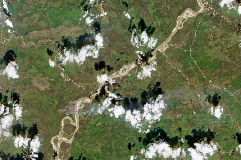
NWT Fire has said one of its main aims right now is stopping the wildfire from reaching the eastern shore of the Liard River, which is the shore on which the hamlet sits.
As of late Tuesday morning, the wildfire agency said the fire had not reached that shore. It has now burned 873 hectares.
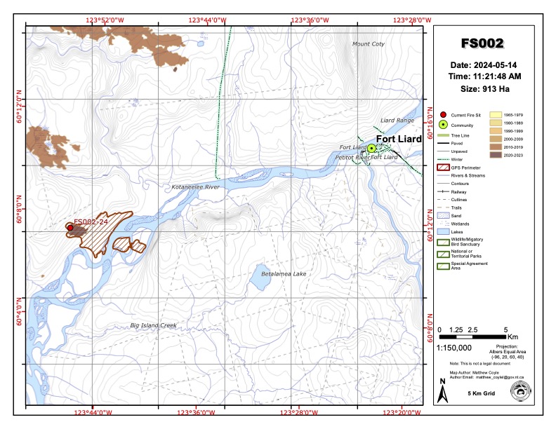
Five fire crews and three helicopters are assigned to the fire, which has the name FS002. Warm and dry conditions persist, with lighter winds blowing up to 20 km/h and gusts of 35 km/h.
Helicopter crews are bucketing Ash Island, in the middle of the river, to reduce the risk of embers reaching the eastern shore.
NWT Fire said there is a chance of thunderstorms, which could increase winds and bring the possibility of lightning, which could start new fires. Equally, there is a chance of rain in the evening.