Yellowknife’s forecast sunny Saturday evening was rudely interrupted by a giant, looming storm cloud that appeared to have come from forest fires to the south.
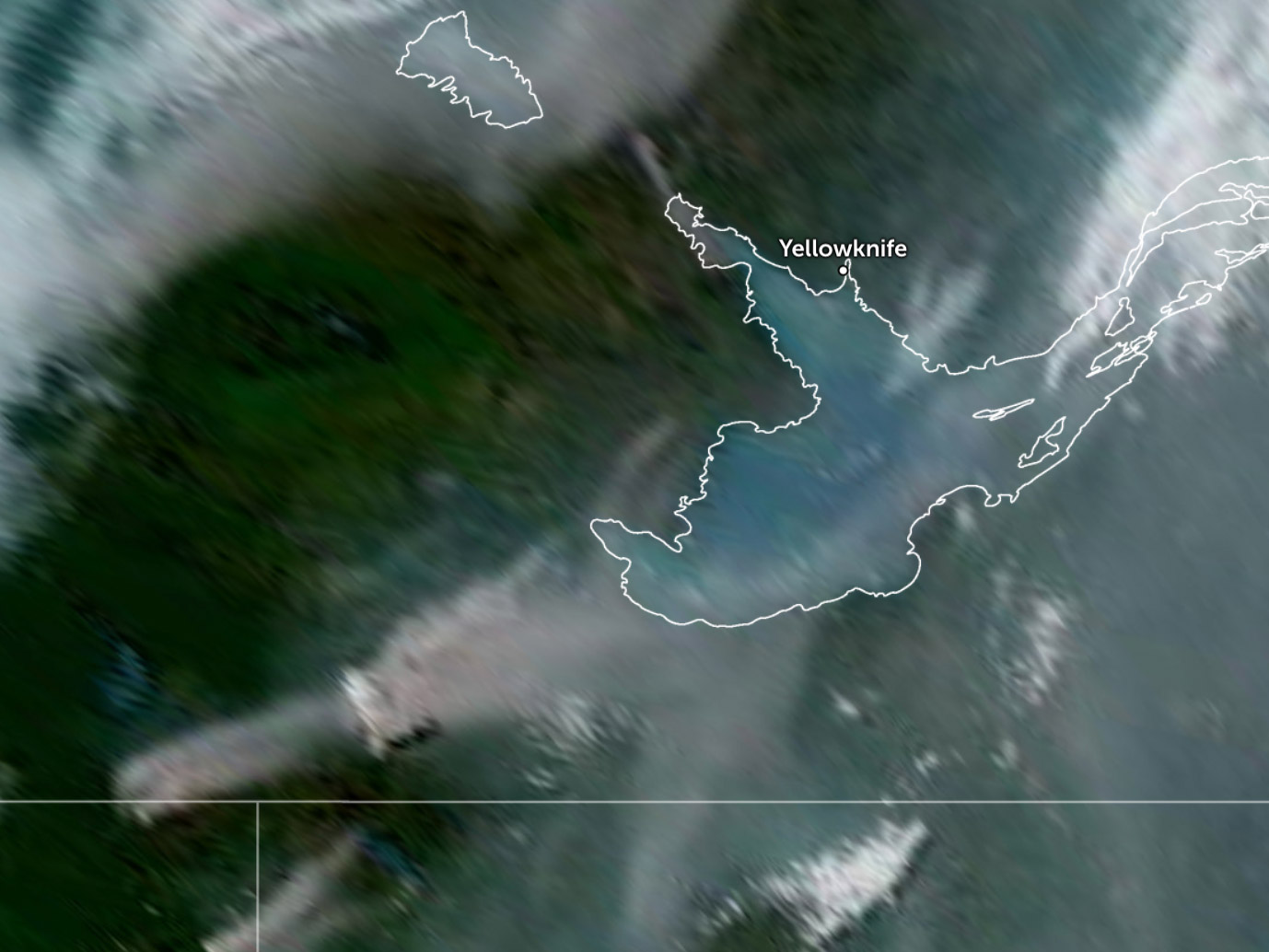
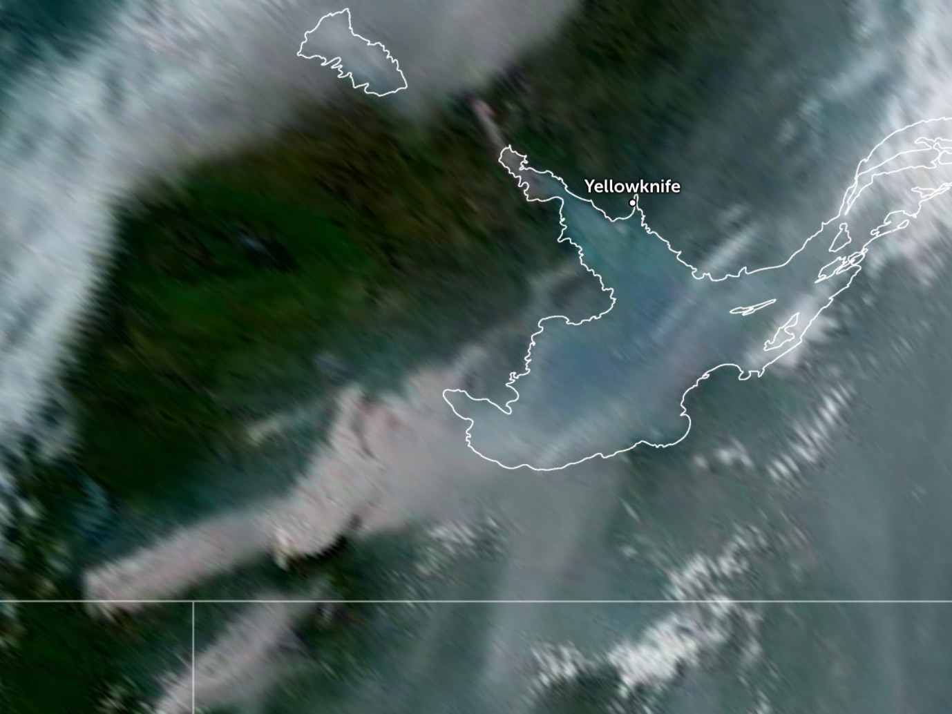
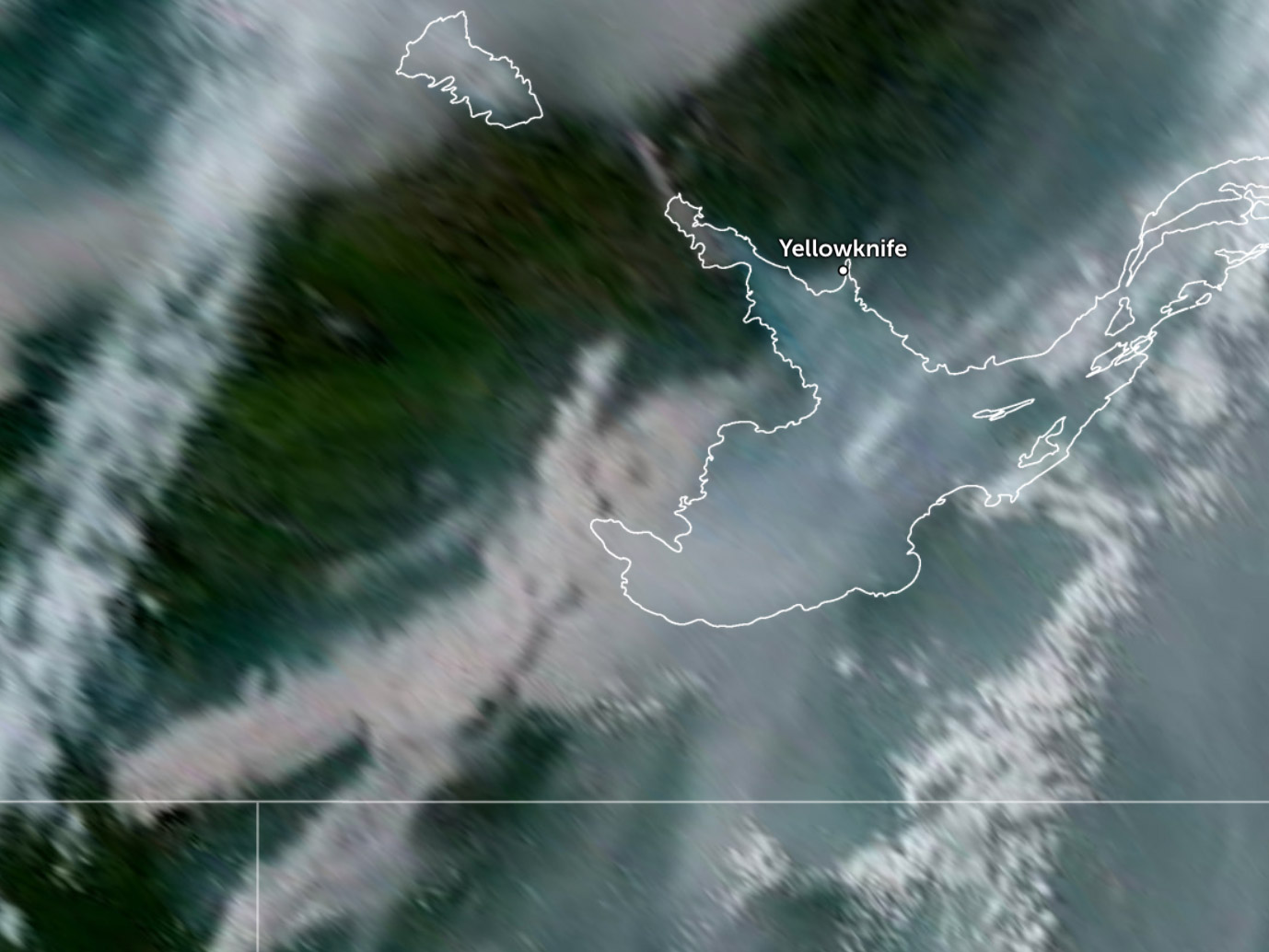
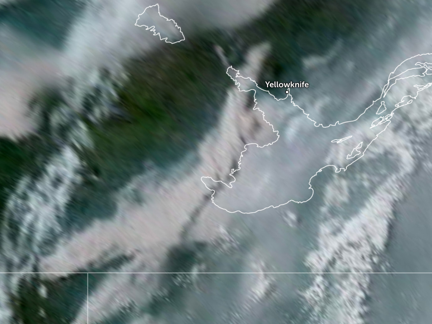
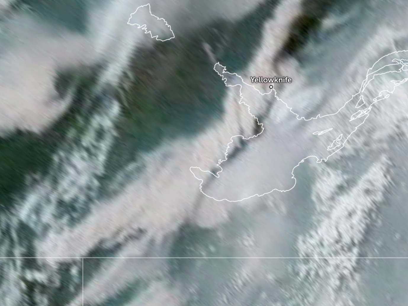
The dark, orange-hued cloud that enveloped the city’s skyline could be seen in satellite imagery gradually making its way up from fires burning west of Kakisa and south of Sambaa K’e.
In a Saturday evening update, the NWT’s wildfire agency attributed the cloud to two fires burning near the engagingly named Dogface Lake, in the South Slave near the NWT border and not close to any communities.
This isn’t the first time in recent history that wildfires have had an impact on Yellowknife’s weather.
Advertisement.
Advertisement.
In July last year, a large wildfire along the North Arm of Great Slave Lake created its own massive thundercloud that brushed past the west side of the city.
Canada can experience dozens of such storms, a form of fire weather whose clouds are known as pyrocumulonimbus, every year.
Another of the fires appearing to contribute to Saturday’s cloud is FS001, burning some 40 km south of Sambaa K’e.
On Saturday, the NWT government said Sambaa K’e was also experiencing heavy smoke and crews were building protections against the fire, which has so far burned some 10,000 hectares on the NWT-BC border.
You can use the gallery below to watch the cloud’s progress from the Dehcho and South Slave to Yellowknife between 2pm and 6pm on Saturday.