


A new wildfire southeast of Yellowknife adds a layer of complexity to smoke forecasts for the city.
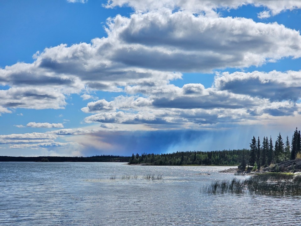
The existence of fire ZF085, which has grown fairly rapidly over five days and is 40 km southeast of Dettah, became grimly apparent as smoke from the fire reached Yellowknife on Monday morning.
Combined with fire ZF011 to the northeast and ZF015 to the west, ZF085 further narrows the availability of wind that doesn’t bring with it acrid smoke, lessening the likelihood of clean air above the city.
The wind is likely to push more of ZF085’s smoke in Yellowknife’s direction on Tuesday.
After that, FireWork – Environment and Climate Change Canada’s smoke modelling system – suggests fires north of Fort Smith could send smoke over Yellowknife on Wednesday.
Advertisement.
Advertisement.
The plumes of ZF011 and ZF085 were clearly visible from parts of Yellowknife and the Ingraham Trail on Monday.
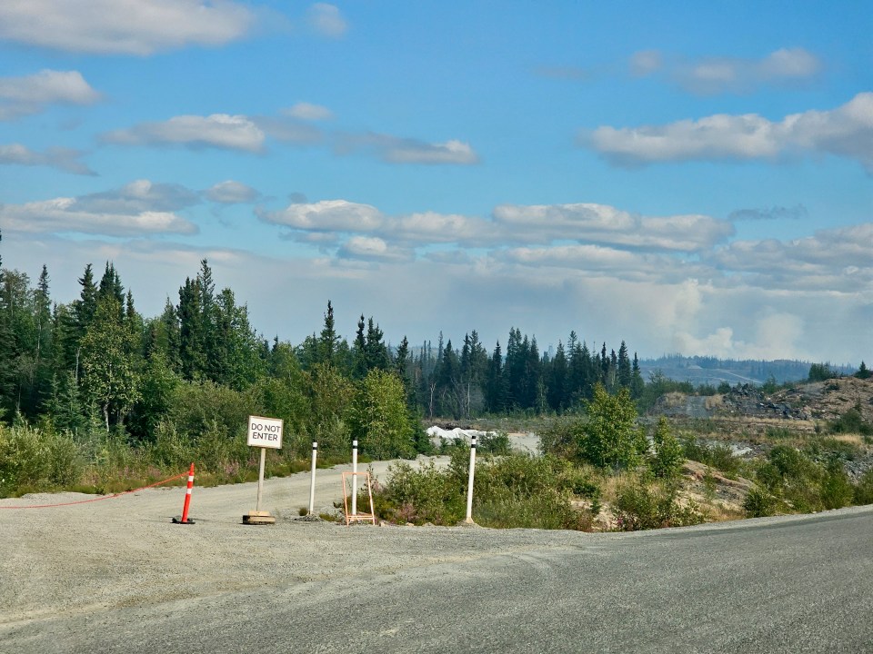
Meanwhile, crews working on fire ZF015 west of Yellowknife warned that a planned controlled burn could create “BIG smoke” (emphasis theirs) in an email on Monday afternoon.
If that burn goes ahead, the plume would be highly visible from the highway and possibly from Yellowknife. Highway 3 had closed by 2:30pm on Monday in anticipation of the controlled burn.
However, the burn’s smoke should be pushed westward, away from Yellowknife.
Advertisement.
Advertisement.
That news will be greeted poorly in Behchokǫ̀, where air quality was significantly worse than the territorial capital’s air quality for much of Monday.
Any smoke pushed west, away from Yellowknife, is highly likely to end up over Behchokǫ̀ instead.
As of 4pm on Monday, the worst air quality in the territory could be found in Tsiigehtchic.
The Beaufort Delta community, which has a large and active wildfire off to the southeast, had Air Quality Index scores of close to 500 throughout Monday afternoon, an “emergency conditions” rating that’s about as bad as it can get.
Inuvik and Fort McPherson, with AQI scores of around 250, were similarly suffering.