

Advertisement.
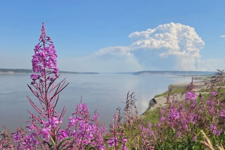
Northern Canada may be in line for a late start to the boreal fire season this year, though parts of the eastern NWT could see elevated fire potential by June.
That’s the verdict of the North American Seasonal Fire Assessment and Outlook, produced jointly by experts in Canada, the United States and Mexico. It sets out what to expect from wildfire conditions over a three-month window.
The latest edition, covering April through June, points to widespread snow cover across northern Canada, continued cool temperatures and wet conditions in Atlantic Canada, keeping fire potential muted across most of the country through April.
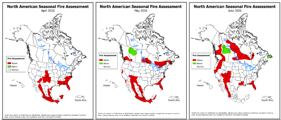
For May, the outlook indicates cool temperatures continuing through the North and northern prairies. That, combined with the snow cover across much of the territory, “suggests a late start to the boreal fire season,” the document states.
Advertisement.
Advertisement.
The picture shifts in June. Much of the country is forecast to see at least a moderate probability of warmer than normal temperatures, with the strongest signal in BC, Labrador and the areas around Hudson Bay.
The outlook expects higher fire potential in June across BC, areas surrounding James Bay and west of Hudson Bay, “and extending into the eastern Northwest Territories.”
An accompanying map defines the eastern NWT high fire-potential area as east of Yellowknife and Fort Smith and just brushing Łútsël K’é.
The forecast follows a cold March across much of northern Canada. Drought in the NWT remains a concern, however.
Advertisement.
Advertisement.
The largest contiguous area of dryness in Canada now stretches from central Yukon through most of the NWT and into northern Saskatchewan, Manitoba and Ontario, the outlook states – with the NWT showing “significant pockets of severe drought.”
Experts always caution that no forecast is a guarantee. An outlook pointing to a slow start does not mean wildfires won’t happen, and conditions can shift quickly once the snow is gone.
The continental outlook is a national-level document and doesn’t reflect the NWT’s own assessment of the season ahead.
NWT Fire usually holds a territorial briefing closer to the start of the season. On Thursday, a spokesperson said the agency would wait until that briefing to comment.
El Niño watch
Looming behind this spring’s forecast is a shift in the broader climate picture.
The outlook says the equatorial Pacific has now transitioned from La Niña to neutral conditions, but “a significant amount of warm water lurks below the surface, indicating a likely rapid transition to El Niño.”
The US Climate Prediction Center now puts the chance of El Niño developing by late spring at 60 percent, rising to 90 percent by summer.
Some forecasters have gone further, suggesting the next El Niño could be a strong one. The CBC reported last month that early projections raise the possibility of a “super” El Niño taking hold later in 2026 – an event that could push global temperatures to record highs and shape weather patterns into 2027.
Advertisement.
Advertisement.
El Niño’s effects on the NWT are usually most pronounced in winter, when it tends to bring milder conditions across western and northern Canada. Its summer signal in the territory is weaker and less consistent.
How strong the next El Niño will be is, the outlook notes, still difficult to forecast confidently this far out.
What an emerging El Niño might mean for the NWT later in the summer or into next winter is a question for forecasts still to come.