

Advertisement.
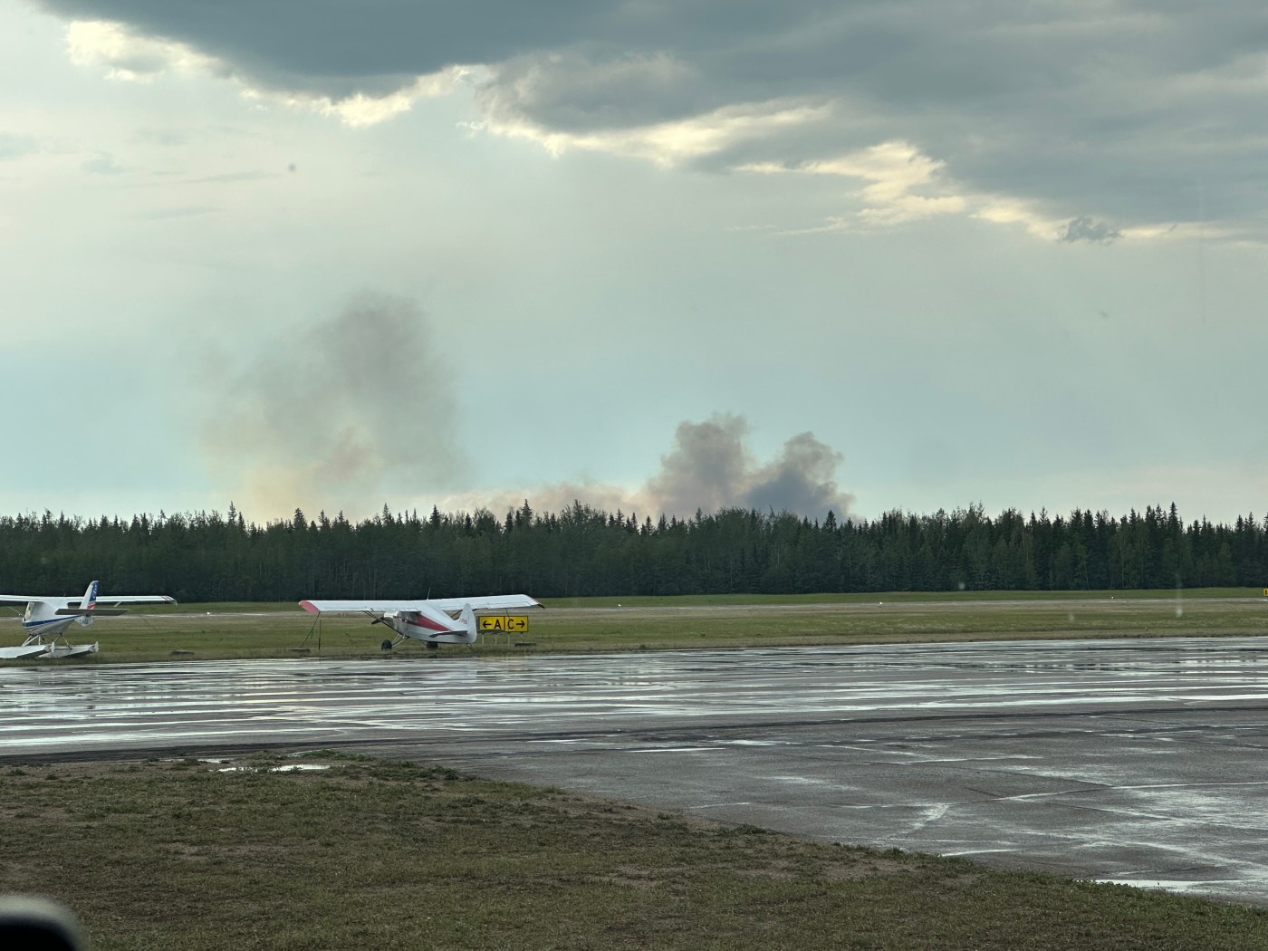
Fort Simpson moved to evacuation alert on Friday evening as a wildfire grew south of the community and west of its airport.
“Residents of Fort Simpson should be ready to evacuate on short notice due to a wildfire in the area. This is currently an alert to prepare,” an alert issued just before 7:45pm stated.
“If you need to evacuate, an order will be issued with further information.”
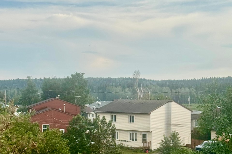
In updated messaging at 9:10pm, the Village of Fort Simpson – which has about 1,300 residents – told people to “prepare for possible evacuation” by packing a go bag and getting fuel. Gas was expected to be available locally until 10pm.
Advertisement.
Advertisement.
Residents are asked to pre-register for a possible evacuation using this GNWT form.
“If you have not registered and an evacuation is necessary, please register as soon as you arrive in the Evacuation Centre you have been directed to,” the village stated.
“If evacuating by personal vehicles after an evacuation order has been issued, no trailers will be allowed to board [the] ferry. If you wish to have a trailer with you it must be across the ferry prior to an evacuation order possibly being issued.”
If you’re in Fort Simpson, you can contact us with updates via this form or by emailing us.
Advertisement.
Advertisement.
At 8:50pm, NWT Fire said eight air tankers and two heavy-lift helicopters were working to suppress the fire by dropping water along its perimeter.
“Multiple wildfire crews have also been assigned and will continue suppression efforts until the fire is brought under control,” the agency stated.
There was no change to the situation as of 10:30pm.

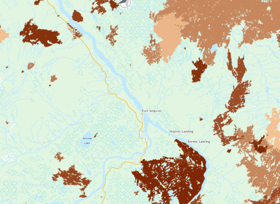
Fire FS016, reported to be naturally caused, is about nine kilometres west of the airfield and a similar distance south of the community, based on its coordinates as shown on NWT Fire’s website.
It is considered out of control and NWT Fire placed its burn area at 60 hectares as of 8:50pm.
“We encourage everyone to remain calm, stay informed, and continue following all recommendations from emergency officials. While there is no need to panic, now is the time to make sure you are prepared should conditions change,” stated Łı́ı́dlı̨ı̨ Kų́ę́ First Nation Chief Kele Antoine.
“We want to extend our heartfelt thanks to the wildfire crews who are working tirelessly to protect our community. Your courage, professionalism, and dedication do not go unnoticed.”
Advertisement.
Advertisement.
The Fort Simpson region has emerged relatively unscathed from recent severe fire seasons that have had much more devastating impacts elsewhere.
Leaders have previously expressed wariness that this made it all the more necessary for the village to prepare, particularly as much of the community is on an island and relies on a ferry for summer access to the wider highway network and the south.
As a result, villagers have spent recent years trying to improve their readiness, including work on a fire break near the airport.
Fort Simpson is also part of a new wildland-urban interface program that aims to better coordinate wildland and structural firefighting when wildfires threaten communities.
The community and territory are already enduring a hard and emotional week related to wildfires and those who fight them. A firefighting aircraft crashed earlier this week while working on a separate fire farther to the west of the village, resulting in the deaths of all three people on board.
A dry and extremely hot weekend is forecast in and around Fort Simpson.
Environment Canada forecasts highs of 34C on Saturday and Sunday, pushing toward the village’s June record high of 34.4C set in 2021.
Further storms aren’t out of the question, with forecasters assessing a minor risk of more unsettled weather in the region.
Advertisement.
Advertisement.
The next showers are forecast on Monday night.
Other Friday fires
Elsewhere, Friday was one of the NWT’s busiest days yet of the 2026 wildfire season, with at least 27 other new fires reported across the territory and more than 50 active fires in all.
Here’s a quick guide to what else changed according to the territory’s wildfire agency. Note that large amounts of lightning rolled across the territory over the past day, contributing to the number of new fires.
Reinforcements from Alberta, BC and Yukon are being sent.
A dozen of the new fires are in clusters well east of Fort Smith and Łútsël K’é toward the barrenlands or north of Gamètì and Wekweètì toward Great Bear Lake, and don’t currently pose any risk to communities. Another nine are across the Sahtu without being too close to communities and are being monitored.
In the South Slave, SS009 is three kilometres north of the Alberta border near Highway 1, with SS010 burning well to the east of the same stretch of road. Crews are working on them.
In the Sahtu, fire VQ015, on the other side of the hills east of Norman Wells, is receiving initial attack from crews. An Alberta incident management team has been deployed to work on fires VQ001 and VQ002 southwest of the town.
In the Dehcho, FS014 is south of Highway 1 between Checkpoint and the Liard River ferry. FS015 is 12 km north of Wrigley. Crews are working on both.
Advertisement.
Advertisement.
Lastly, one new fire technically considered to be in the Beaufort Delta management zone is tucked into the Mackenzie Mountains far west of Norman Wells.
“Hot and dry conditions are expected to continue, with risk of dry lightning across the territory,” NWT Fire stated.
The long-term forecast at the start of the season had warned that after a quiet May, the territory’s fire season was expected to become more severe from June to August.