

Advertisement.
Water levels dropped slightly in Fort McPherson on Thursday, with a limited evacuation understood to be taking place over concerns about access to drinking water.
Teetl’it Gwich’in Band Chief Liz Wright told the CBC Elders, infants, and people who are sick would be moved from the community on Thursday and won’t return until the state of emergency is declared over.
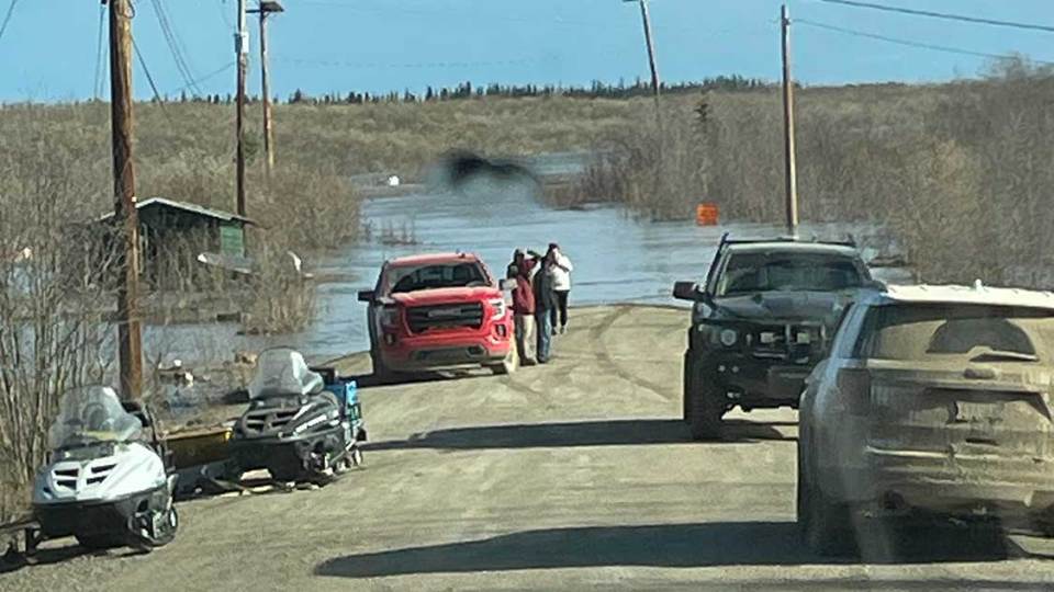
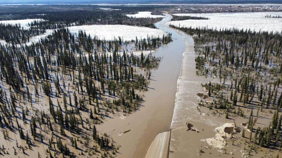
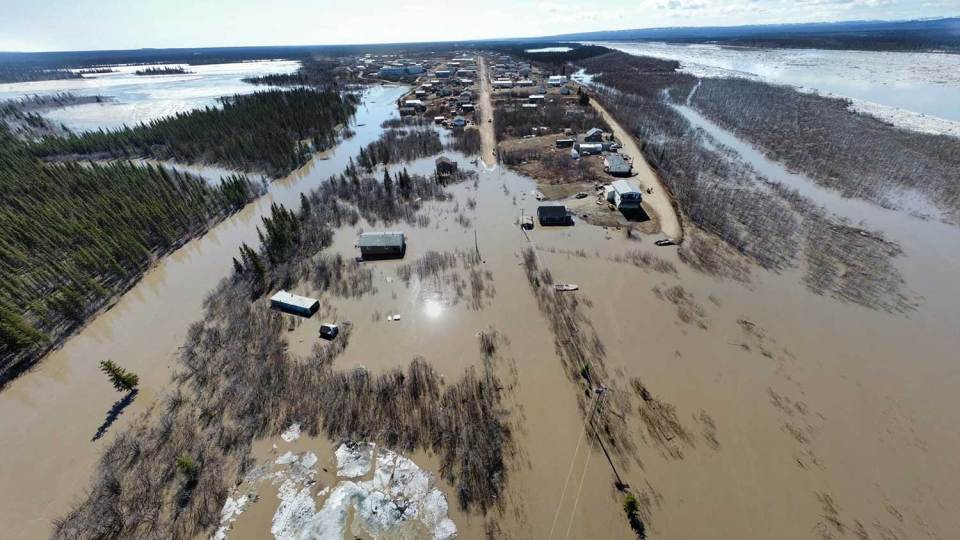
The Peel River has been pouring into low-lying areas of the community as ice jams during breakup increase water levels. The road outside the community, leading to its airport and its trucked water source, has been flooded.
Advertisement.
Advertisement.
Wright told Cabin Radio a state of emergency will remain in effect until access to drinking water is restored. There are concerns over the integrity of the road and the extent of repairs needed.
On Thursday, resident Trevor Peterson said water levels appeared to have dropped very slightly.
A temporary gauge and camera have now been reinstalled on the Peel River with Water Survey of Canada assistance after ice broke the camera and gauges previously in place. That equipment helps hydrologists to understand what is happening on the river.
At noon on Thursday, the NWT’s Department of Environment and Climate Change said water levels had dropped by about 35 centimetres since Wednesday evening at the temporary gauge location.
Advertisement.
Advertisement.
ECC believes water levels peaked at around noon on Wednesday.
Speaking on Wednesday, Ryan Connon, a hydrological modeller for the NWT government, said water levels are slowly dropping as ice moves down the river.
A large, 25-km ice jam had previously formed around Fort McPherson, stretching 10 km downstream of the town and 15 km upstream. However, Connon said, that ice has since started to move.
The danger is not yet over as another jam could yet occur. If it doesn’t, Connon said, water levels will drop and floodwater could rush back into the river quite rapidly.
A challenging time
Fort McPherson is trying to handle a flood at the same time as residents grieve the loss of community members.
On Monday, former mayor and ex-NWT premier Richard Nerysoo told Cabin Radio Fort McPherson was enduring a challenging time, “dealing with supporting families while, at the same time, dealing with the flood.”
The hamlet declared a local state of emergency on Tuesday evening as access to fresh water and the community airport was cut off.
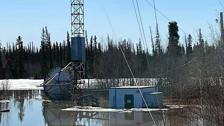
High water has also knocked out Fort McPherson’s radio transmitter, ending access to CBC broadcasts and preventing officials from broadcasting information on community station CBQM.
Advertisement.
Advertisement.
The only way citizens have been able to leave the town is via helicopter for emergencies.
In Aklavik, meanwhile, residents are told to “prepare for the possibility of high water at breakup.”
ECC said water levels underneath the ice in Aklavik are rising quickly, with much now riding on how ice and water move through the Mackenzie Delta’s many channels.