
Thunderstorms rolled across Fort Simpson on Wednesday afternoon and evening but storms forecast for Yellowknife missed the city to the north.
“Conditions are favourable for the development of severe thunderstorms that may be capable of producing heavy rain this afternoon and evening,” Environment and Climate Change Canada had warned for both communities in an advisory on Wednesday.
A thunderstorm watch means there’s a good chance a severe storm, with either heavy rain or wind gusts of 90 km/h or stronger – or both – could happen in the immediate future.
However, it’s one tier down from a thunderstorm warning (yet to be issued as of 3:20pm MT). Warnings are is issued when radar, satellite, or on-the-ground reports indicate a severe storm is imminent.
Advertisement.
Advertisement.
Weather data for Fort Simpson records storms between 3pm and 5pm on Wednesday, with a further flurry of thunder and light rain later that night.
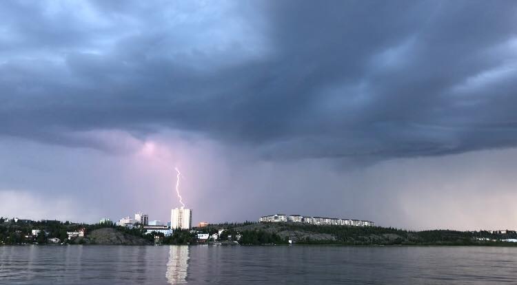
But the weather did not break in Yellowknife, which remained mostly clear with little wind overnight.
A map of NWT lightning shows the bulk of recent strikes occurring to the north of Yellowknife and passing along the lakes lining the Ingraham Trail. Lightning had been reported near Cameron Falls earlier in the day.
The storm advisory came on the same day that much of the Dehcho and South Slave was placed under a heat warning, with temperatures nudging toward 30C for most of the next week.