
Advertisement.
The NWT government says spring break-up is “near complete” along the Peel River and monitoring is now only focused on the Peel River and Mackenzie Delta.
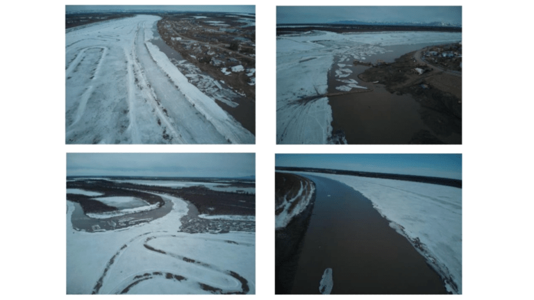
In its latest break-up monitoring report, The GNWT said water levels in the East Channel, West Channel and Peel Channel of the Mackenzie River are continuing to rise under the ice. It said water levels at Aklavik are currently above average, and average at Inuvik for this time of year.
The report said satellite imagery from May 20 and 21 showed rubble ice is jammed in the “turtle,” where the Peel Channel splits around the Mackenzie Islands. There is some open water downstream from the ice jam, the GNWT said.
On the Peel River, the GNWT said May 21 satellite imagery showed some rubble ice where the river flows into the Mackenzie Delta.
Advertisement.
Advertisement.
Water levels peaked at Fort McPherson on May 18 and 19, but have since fallen the GNWT said.
The GNWT said water levels may increase slightly on the Peel River with rain expected near Fort McPherson and Aklavik, but will remain within normal ranges.