
Advertisement.
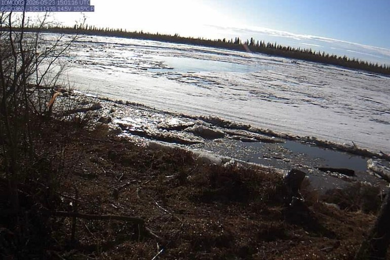
Water levels near Aklavik are rising at 0.5 meters per day and may soon approach water levels of past flood events, the GNWT said in a Saturday afternoon update.
As of just before 12pm on Saturday, the Peel Channel was at 14.4 metres. Past flood events happened when water levels were above 15.5 metres the GNWT said in its latest break-up monitoring report.
The GNWT said the increase is in part because of a rubble ice jam where the Mackenzie River meets the Mackenzie Island, also known as the “Turtle.”
Ice in the “Turtle” area and Middle Channel has not “significantly” changed over the past few days and is still “relatively intact with some open water developing” the GNWT said.
Advertisement.
Advertisement.
The Saturday update also said ice is jammed in the East Channel three kilometres downstream of where it meets the Mackenzie River. Water levels on the East Channel near Inuvik, and on the Middle Channel measured at Horseshoe Bend and Napoiak Channel above Shallow Bay are also rising.
The GNWT said cloudy conditions over the Beaufort Delta next week might slow river ice degradation.