


Advertisement.
Head spinning from the number of recent NWT highway closures brought on by nearby wildfires? You aren’t alone.
Major tech companies seem to be struggling to stay on top of the situation, too.
Early on Saturday, several Yellowknife residents reported an inability to plan any Google Maps route to or from Yellowknife involving Highway 3.
When Cabin Radio attempted to plan a route south from Yellowknife to Edmonton at 10:30am on Saturday, Google Maps responded: “Sorry, we could not calculate driving directions.”
Advertisement.
Advertisement.
Nor would Google’s mapping app come up with directions from Yellowknife to Hay River or even Behchokǫ̀.
Eventually, some playing around with points on the map appeared to suggest Google Maps thought Highway 3 was closed around 20 km west of the city.
At the time, the highway was open and had been for almost a week, despite wildfires in the area. (By 5pm, six hours after this article was first published, Google’s premonition had come true: the highway was closed to allow a wildfire to roll across it, well outside Yellowknife. It had reopened again by 7:30pm.)
Google has been approached for comment.
Advertisement.
Advertisement.
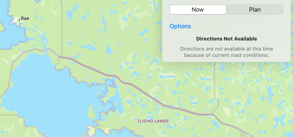
It wasn’t the only company whose maps were producing a similar result. An attempt to plan a route away from Yellowknife using Apple Maps returned an error stating: “Directions are not available at this time because of current road conditions.”
Is Highway 3 open? Check the GNWT highway conditions page
For some residents already uneasy about the wildfire situation, seeing the road south mistakenly disappear from their app might have been disconcerting.
The good news? For the most part, driving to or from Yellowknife is a fairly simple act for which a map is not ordinarily required. Find Highway 3, check it’s open, stay on it. Good luck.