


Advertisement.
For the past two days, “unfavourable flying conditions” have meant firefighters haven’t been able to access a wildfire complex burning over the border of Wood Buffalo National Park.
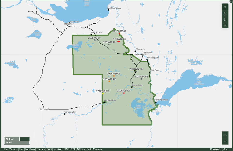
The wildfires – named the Klewi Complex – include a large fire that’s been burning since May 22 and crossed the border of the national park into the NWT on June 4, and a smaller fire that was discovered in Wood Buffalo on May 30.
After weeks of high to extreme fire danger levels in the national park, the fire danger is now considered low due to the considerable rain the area received. NWT Fire lists the fire danger for all communities in the South Slave – aside from Fort Providence – as moderate to low.
The Klewi Complex is 53,124 hectares as of a Tuesday evening Parks Canada update, and is about 21 kilometres northeast of Highway 5. The agency says there is no threat to communities or infrastructure at this time.
Advertisement.
Advertisement.
The wildfire is also burning near a whooping crane nesting area, but a Wood Buffalo National Park ecologist said only a few nests are close to the fire perimeter and whether those have been “truly affected” by the fire is unconfirmed.
Parks Canada said two days of unfavourable weather conditions meant firefighters haven’t been able to safely access the fire perimeter or fly over the fire.
On Monday, Parks Canada said crews did equipment maintenance and assessed “potential helicopter landing sites along Highway 5 for future instances when inclement weather prevents aircraft from landing in Fort Smith.” Crews completed safety training on Tuesday.
Parks Canada also said it finished its transition to a fresh incident management team. With incidents that go on for long periods of time, responders are often replaced as they get fatigued and reach their maximum time on the incident.
Advertisement.
Advertisement.
When the fire crossed the park’s border, Parks Canada said it set up a unified command structure with the GNWT, meaning both organizations are making fire response decisions to better coordinate resources and tactics.
Parks Canada said it was unable to do infrared drone scanning Monday night, but scans from Sunday night found 600 hotspots along 34 km of the southern perimeter. Hotspots are any remaining sources of heat after the main fire front has passed, like smouldering roots or stumps, burning organic material in soil, partially burned logs or debris.
When it is safe to do so, the agency said firefighters will scan for hotspots on the northeast perimeter of the wildfire near the Little Buffalo River.